
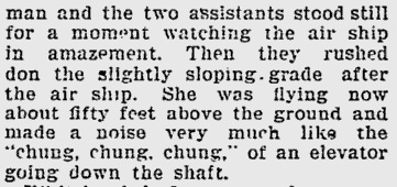
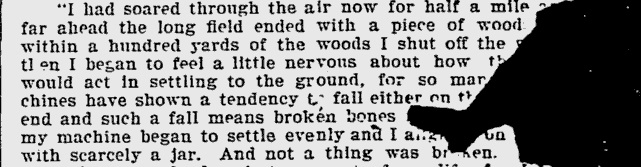
Illustration of the first flight that appeared in the Bridgeport Sunday Herald, Aug. 18th, 1901.
Where was the first flight? Not in North Carolina. Not in Ohio.
[For detailed information, read the new book, “Gustave Whitehead: First in Flight“, available on Amazon.com in print format and as an eBook.]
The first successful airplane flight occurred in “a field back of” Fairfield, Connecticut, according to eyewitness Dick Howell. See the description from the Bridgeport Sunday Herald article for Aug. 18, 1901, on p. 5. The Bridgeport Evening Farmer confirmed that the famous flight was made in Fairfield, near the beach:
*NEW! (June 20, 1910) “Back in 1901 [Gustave Whitehead] made a flight in an airship of the aeroplane type, out near Fairfield beach...” [See article on this site: Local newspaper evidence for Whitehead’s 1901 flights – did it exist?]
A second set of manned flights that took place, later that day, on August 14th, were specifically described in witness affidavits as occurring at Lordship Manor on the sea beach, part of Stratford, CT, supported by several newspaper accounts in the fall.
After examining the evidence, Major William J. O’Dwyer, Whitehead researcher, author, and international expert on Whitehead for 45 years, ultimately thought the first flight took place at a location called “Turney’s Farm” (Fairfield, CT), about 3 miles from Whitehead’s home and shop. This site provided a number of private, raised, long pastoral fields on then-high level plateaus, with gentle slopes. There was an elevated set of large “upper” fields that ran east to west along the Post Road between what is now Riverside Drive and Turney Road, and a smaller, long field about half a mile south, in the same direction, accessed via Turney Road. Near Long Island Sound, Turney Farm was not far from present-day Fairfield Beach and Turney Road. The Turney Farm location, indeed, is “back of Fairfield”, as reported in the Howell article of August 18, 1901, near the then-existing highway, the Post Road and Old Post Road, accessed by going along Fairfield Avenue from Whitehead’s shop in the West End of Bridgeport (see 1893 Hurd map below). Maj. William J. O’Dwyer, longtime Chairperson of the International Whitehead Research Committee, described why this location appeared most viable:
“The route taken by Whitehead and his helpers to reach the flight site from Bridgeport (as described in Howell’s Herald story on August 18) … and the illustration drawn by Howell all combine to place the site at Turney’s Farm, about a half mile north of the Long Island Sound…’From all indications,’ said O’Dwyer, ‘Whitehead made his takeoff run diagonally across the farm, corner to corner, heading southwest into the prevailing wind. This gave him a potential flight course of at least a mile before reaching Fairfield Beach*. Howell’s drawing depicts Whitehead aloft in Airplane No. 21, a line of elms and chestnut trees atop a knoll in the distance, and two stone walls intersecting near the trees. Today, the walls are still there, easily found and identifiable as those that Howell sketched almost a century ago!”
“Gustave Whitehead and the First-Flight Controversy”
Aviation Magazine
http://www.historynet.com/gustave-whitehead-and-the-first-flight-controversy.htm
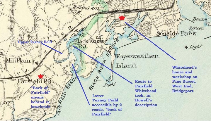
1893 map of South Part of Fairfield County by Hurd shows upper and lower Turney Farm fields with access points.
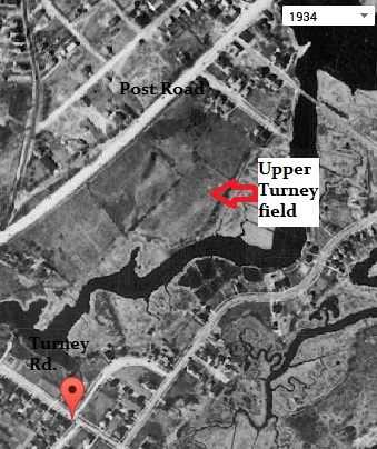
Upper Turney Farm field shown south of the Post Road in 1934.
Turney Farm lower field, pictured in 1934 aerial photo
Gustave Whitehead’s first successful, powered, sustained flight was said to be 1/2 mile in length, according to the news article and later statements. That would mean that the potential flight course of 1 mile to Fairfield (now called Jennings) Beach would place the landing point at about 1/2 mile – 1 mile away from the beach, behind the town’s center and town hall, in the field where Howell described it.
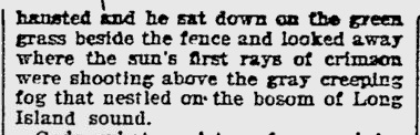
Howell described Whitehead’s successful, sustained, manned, powered flight as taking off from the slightly sloping grade of the field, flying 1/2 mile, and landing in the same field before the woods (trees) began. Afterward, “exhausted”, Whitehead “sat down on the green grass beside the fence” [see sketch above, which is also of a field], turning his head to look at [in the distance] the first rays of sun coming through the fog over Long Island Sound. This was all taking place on a half mile long field, not a beach, as has been mistakenly reported to the CT media in August, 2014.
The plane began its flight on a slightly sloping grade.
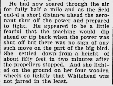
The plane flew for half a mile, the end of the field ahead.
Whitehead landed in a field before a woods.
“I had soared through the air now for half a mile and not far ahead the long field ended with a piece of woods. When within a hundred yards of the woods I shut off the power and then began to feel a little nervous about how the machine would act in settling to the ground, for so many flying machines have shown a tendency to fall either on the front or hind end and such a fall means broken bones for the operator. My machine began to settle evenly and I alighted on the ground with scarcely a jar. And not a thing was broken.” (Bridgeport Sunday Herald interview with Gustave Whitehead by Richard “Dick” Howell, right after the flight)
Exhausted, Whitehead sat down on the GREEN GRASS BY THE FENCE (pictured in Howell’s sketch, at top of article). He could see the fog on the Sound.
1/2 mile field with slight slope + ending flight on field before woods + sitting on green grass = a flight in an approx. half mile long field
Most likely first flight location, Aug. 14, 1901: Turney’s Farm, Fairfield, CT
Research into the first flight location is under additional investigation. The Turney Farm fields, both upper and lower, were definitely accessible in 1893, shown on Hurd map above, and thus, in 1901, from the Post Road and southwestern end, via the Old Post Road, then Turney Road or South (lower) Benson Road (see map below). The upper fields had room to spare for a half mile flight. The lower field measured approximately .3 miles in length but with additional room if flown diagonally.
Since Revolutionary times (1770’s) this area was known as “back of Fairfield”, and the road at top (Old Post Road) known as the “Old Highway”. The lower field was formerly, in the very early years of the town, the site of Peter Penfield’s grist mills and later, part of the Turney family farm. The reason that this was considered the “back” of Fairfield, historically, is that it was behind the original center of town (current day Town Hall and Fairfield Museum area) and Town Green, referred to as such when the British landed at the beach and approached Fairfield “from the rear” to burn most of the town, during the Revolutionary War. A road the soldiers traveled can still be seen at the lower right (eastern) edge of the lower field, known as “the Corduroy Road”, so named due to the use of logs placed perpendicularly along the edge of the field along Ash Creek, so people and wagons would not become mired in the mud. The Turney / Penfield Farm area is hallowed historic ground in Fairfield, for many compelling reasons which remain unknown to most residents today. The Ash Creek corduroy road (on the lower field) is a State Archeological Preserve, designated in 2009.
Bpt Sunday Herald, Aug. 18th, 1901 sketch of first flight and location
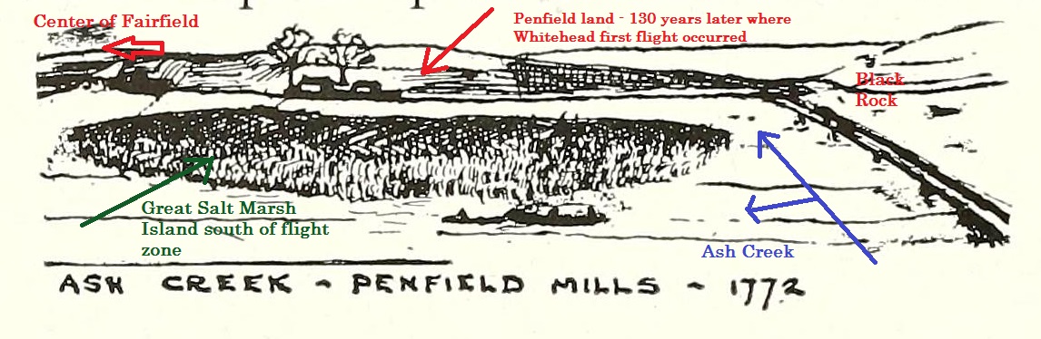
Penfield field in 1772, view behind 2 grist mills is flight field over 100 years later.
Current day access from northeast corner of the Ash Creek Preserve, showing elevation of lower field, above sea level. Photos courtesy of Ed Collins of Milford, CT, Chairman of Gustave Whitehead Advocacy Committee, taken August, 2014.
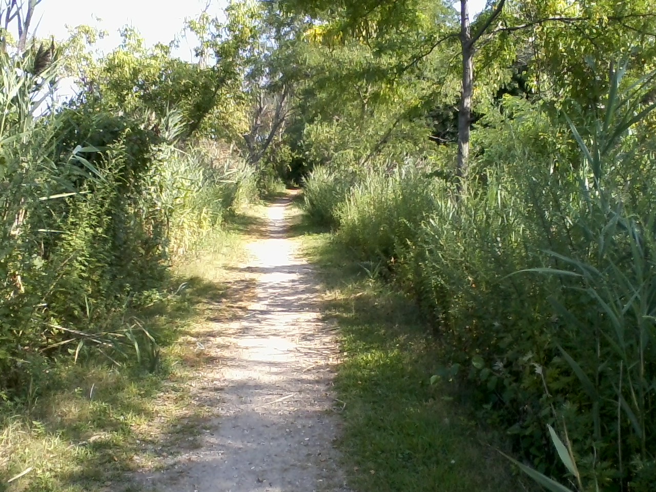
(Aug. 2014) Upper approach to Penfield / Turney field, now named Ash Creek Riverside Preserve.
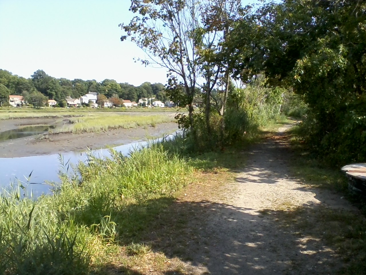
Upper approach leads along Ash Creek. Shows elevation, approx. 20 ft above sea level.
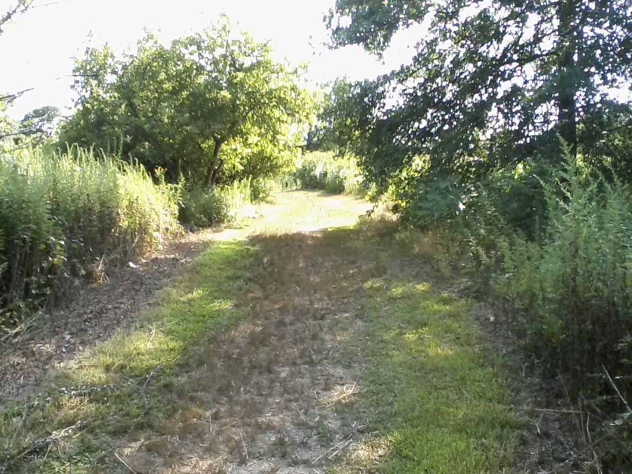
Approaching even higher ground at top of field, which is at same elevation as in Whitehead’s day.
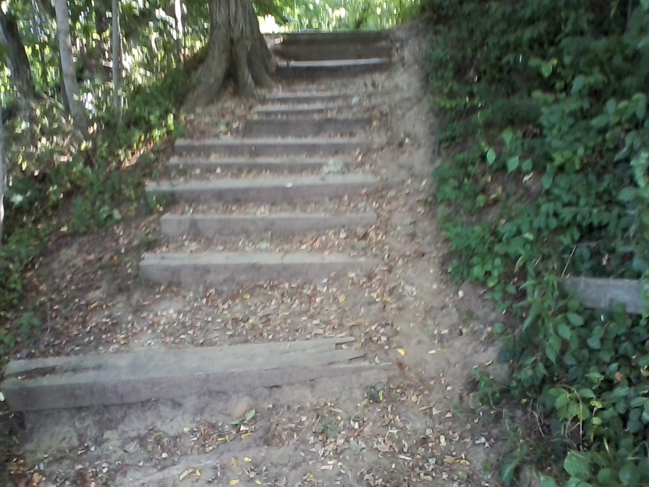
Steps from path leading to top of field – shows increased elevation, steps are new, not there in Whitehead’s time (1901)
View of lower elevation, center of Turney farm lower field seen in August 2014. Overgrown with vegetation less than a century old. Note tree line at far end of field, 1/3 to 1/2 mile away
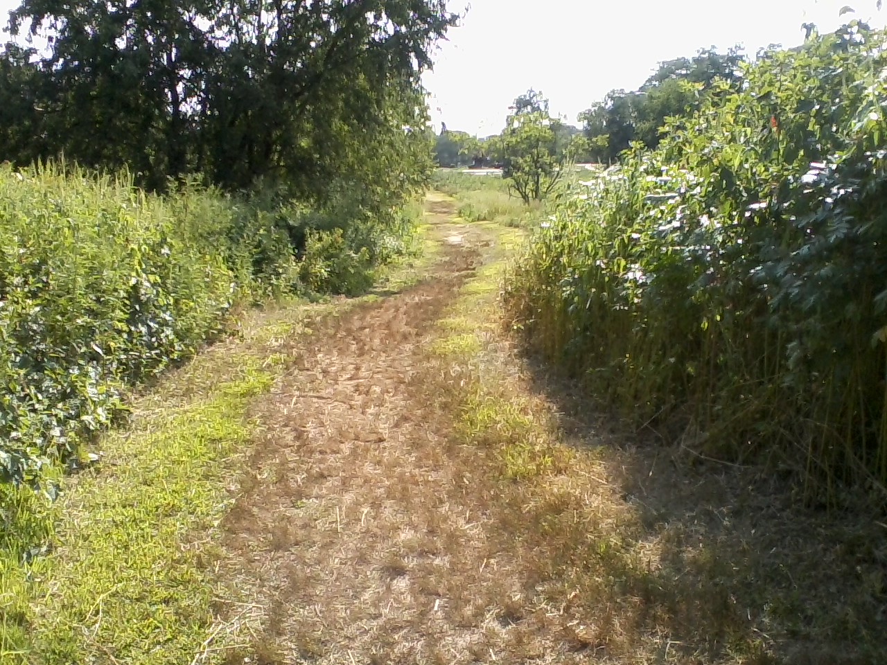
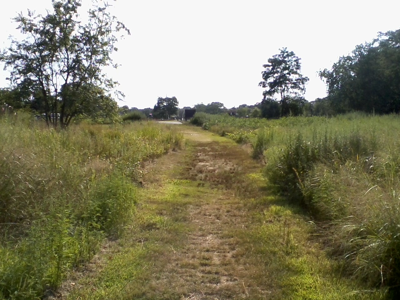
Higher ground with “slight slope” downward, top of field region – just as described in the Howell article, “Flying”, in the Bpt. Post of Aug. 18, 1901. The high ground was at about 20 feet above sea level in the 1880’s, and one may assume, in 1901, as well.
The upper field is no longer there – it is now a housing development, called “Shoreham Village“; the property has been graded, the original contours of the land are no longer visible. The lower field has been preserved in part, though its southeastern end was made into the South Benson Marina, accessed via Turney Road.
Howell’s article mentions only a large field along the highway – for both takeoff and landing. The Turney Farm, with both its upper and lower fields, is an area that meets all the criteria for the place Whitehead made his first successful, sustained, manned powered flight.
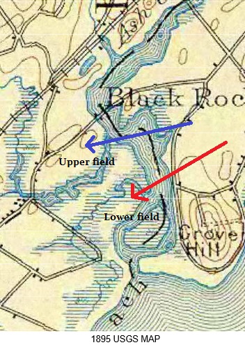
1895 topographical map showing upper and lower Turney Farm fields.
![]()
Elevation was 20 feet above sea level at northeast end of first flight site, in 1880’s – 1990’s (where flight would have started). The area had a number of feet of topsoil removed in the 1960’s.
Follow @gwfirstinflight
© 2013-2014, Susan Brinchman